- January 21, 2025
-
-
Loading

Loading

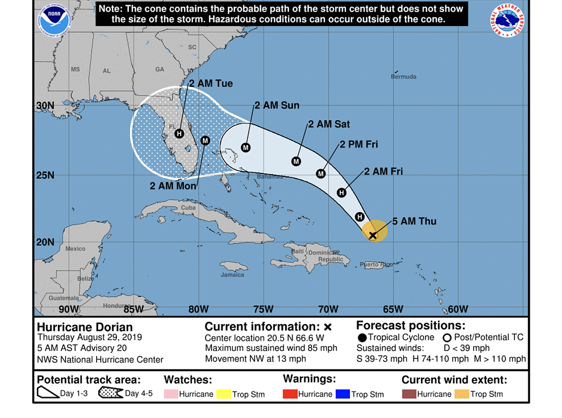
Hurricane Dorian turned southward overnight, with its track as of the morning of Thursday, Aug. 29, heading toward the Melbourne area, according to the National Hurricane Center.
Forecasting models diverge after the 48-hour point, with the American GFS system showing a weaker storm making a more northward swing toward the Florida/Georgia border, while the European UKMET and ECMWF show a stronger storm heading toward South Florida.
The NHC's forecast and tracking image combines them, and shows maximum winds of 125 miles per hour.
"Soon after the previous advisory was issued, Dorian appeared to have a bit of a hiccup in its structure," The National Hurricane Center reported in a morning update Aug. 29. "A dry slot was noted penetrating into the southeastern portion of the circulation, with the eye becoming cloud- and rain-filled."
The storm is heading northwest at 11 knots, and the NHC has high confidence in its track for the next 48 hours, expecting Dorian to continue in that direction, then start to turn west-northwest across the Straits of Florida.
All of the models show Dorian strengthening again soon over warm waters.
"Dorian is likely to reach major hurricane strength in the next day or two and is forecast to maintain that status until it reaches land," the NHC message states. "Key Messages: 1. The risk of dangerous storm surge and hurricane-force winds later this week and this weekend continues to increase in the central and northwestern Bahamas and along the Florida east coast, although it is too soon to determine where these hazards will occur. Residents in these areas should ensure they have their hurricane plan in place and not focus on the exact forecast track of Dorian's center. 2. Heavy rains are expected to occur over portions of the Bahamas, Florida, and elsewhere in the southeastern United States later this week and into early next week."