- December 15, 2025

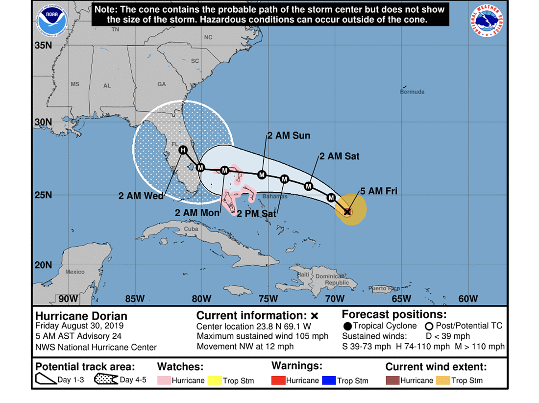
The expected track of Hurricane Dorian has again shifted southward slightly overnight, with models now showing landfall around south-central Florida. The NHC track shows landfall in the area of Jupiter or Port St. Lucie.
Models still diverge on exactly where, and it's still too early to predict where the highest storm surge and wind impact areas will be in Florida, according the NHC, as the storm may turn north and head up the coast.
The storm strengthened overnight to a Category 2 hurricane and is expected to strengthen to a Category 4 and to slow considerably as it approaches Florida, "placing some areas of the state at an increasing risk of a prolonged, drawn-out event of strong winds, dangerous storm surge, and heavy rainfall," according to the National Hurricane Center's update the morning of Friday, Aug. 30. Landfall is expected in the early morning hours on Tuesday, Sept. 3.
Hazardous weather associated with the storm could affect Florida for several days early next week, and heavy rain is expected, according to the NHC.
As of Friday morning, Dorian had an intensity of 90 knots and was moving northwest at 10 knots.
"Dorian is now being steered between a mid-tropospheric high centered near Bermuda and a mid-/upper-level low located over the Bahamas," the NHC message states.
Most forecasting models show Dorian moving near or over the northern islands of the Bahamas Sunday, Sept. 1 and Monday, Sept. 2. The northwest Bahamas is now under a hurricane watch.
"There is more spread among the deterministic models and their ensemble members during that time, with disagreement on exactly when and where Dorian will turn northwestward and northward on days 4 and 5," the NHC message states.