- January 30, 2025
-
-
Loading

Loading

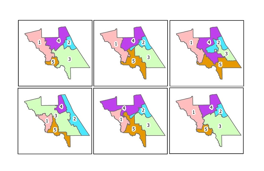
A joint meeting between the Volusia County Council and the Volusia County School Board to discuss proposed redistricting maps will be held at 5:30 p.m. on Monday, Oct. 18, at the Thomas C. Kelly Administration Center in DeLand. The maps will dictate what the governmental bodies' districts will look like for the next decade, and designate which populations vote for which representative.
In the County Council, five of the seven council members are elected by voters within their districts. In the School Board, all members are elected in this manner. Districts are redrawn every 10 years as a result of the U.S. Census, and the 2020 count showed Volusia's population has increased by almost 60,000 people.
The County Council discussed a few redistricting maps at its meeting on Tuesday, Oct. 5, deciding on map option "F" as its preference. According to a county press release, this map would keep two of the districts unchanged, while moving the city of Lake Helen to District 3 and parts of the southern section of Port Orange into District 2.
“We want to keep it as simple as possible,” Councilman Ben Johnson said.
However, the county's map did not take into account the locations of schools, and one of the criteria for the School Board's maps is to keep schools in existing districts as much as possible. Many of the maps, both from the county and School Board, also propose a District 3 that is vastly larger in landmass as compared to its current boundaries, extending from the northwest section of U.S. 92 between DeLand and Daytona Beach down to the city of Osteen.
"That's one thing I think a lot of us have to consider: How many schools we have to serve and visit," said School Board Chair Linda Cuthbert, who represents District 3, at the School Board meeting on Tuesday, Oct. 12. "It's not just the population, it's not the people who vote, but the ones we have to serve because I'd hate for one board member to have two dozen [schools] and another member have less than 12."
She pointed out that the School Board's plan "I" meant her district would lose Creekside Middle School, leaving only one middle school in her entire district, and less than a dozen schools. District 1 would have almost double that number of schools. Plans G-L would keep the schools District 3 would lose in plan "I." Some of the maps also split the city of DeBary between Districts 1 and 5. Some members wanted to see if Plan "K" would work with the county instead.
District 4 School Board member Carl Persis said he felt no city with a population under 50,000 should be split.
"And I think any city that is split should only be split at the most twice," Persis said. "It shouldn't be split three times if we could avoid doing that."
Both the council and the School Board need to choose a map before Dec. 31. They are not required to choose the same map, but the bodies are aiming to do so if possible.
"I am very hopeful that the School Board will join us and have the same districts,” said County Council Chair Jeff Brower at the council's meeting last week. “I think it would be much easier for the public to understand where they’re voting and who they’re voting for.”
To see the School Board maps, visit https://bit.ly/3AA4suB. To see the county maps, visit https://bit.ly/2YH1pDG